


White Paper analyzing 12,854 Permian Basin oil and gas wells shows DirtWork Alert™ satellite imagery service accurately predicts new oilfield drilling ahead of any other source
HOUSTON — (BUSINESS WIRE) — September 15, 2020 — Sourcewater, Inc., the technology leader in upstream energy and water intelligence, released its white paper, “Permian Basin Well Pads versus Drilling Permits for Predicting New Drilling.” The research, led by a Rice University research scholar, analyzed 12,854 Permian Basin oil and gas wells to measure the time and probability relationships between drilling permits, new drilling events and oilfield well pads detected in Sourcewater’s patented DirtWork Alert™ satellite imagery AI/ML analytics service.
This press release features multimedia. View the full release here: https://www.businesswire.com/news/home/20200915005483/en/
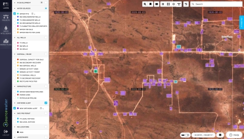
DirtWork Alert satellite imagery predicts Permian Basin oil wells before drilling permits (Graphic: Business Wire)
Key findings include that 1 in 5 Texas drilling permits and only 1 in 2 New Mexico permits were ever drilled. At the same time, satellite imagery detection of well pad construction predicted fully one-third of all drilled wells on median almost three months ahead of any drilling permit filing. Moreover, drilling permits paired with satellite-detected well pads were far more likely to be drilled than permits without a well pad, in about half the time of permit without a pad.
“Traditional energy intelligence relies on regulatory records such as drilling permits and completion reports,” said Sourcewater Founding CEO Josh Adler. “These public data are self-reported, often late, missing or erroneous, and do not even attempt to track some of the most important energy activities on the ground. Sourcewater is pioneering AI/ML analysis of satellite imagery to identify energy activity that never shows up in regulatory data, or shows up too late to matter. We contextualize those results in the best data gathering, analytics and geospatial visualization platform in the industry to show upstream energy activity earlier and better than any other source. In a tough time for our industry, we are applying all our creativity, technology and perseverance to give our clients an edge.”
To get a free copy of the White Paper, visit: https://info.sourcewater.com/permian-dirtwork-white-paper
About Sourcewater
Sourcewater, Inc., ( www.sourcewater.com) an MIT spinout based in Houston, Texas, is the technology leader in upstream energy and water intelligence. Sourcewater gathers, analyzes and visualizes satellite imagery, regulatory data and subsurface insights to show oilfield activity earlier, more completely and more accurately than any other source. The company has been granted nine U.S. patents.
View source version on businesswire.com: https://www.businesswire.com/news/home/20200915005483/en/
Contact:
Camille Alfaro, Director of Marketing
P: +1 (713) 909-4664
E:
camille@sourcewater.com


 Animation, 3D Art and 3D Models")