


- Precise representation of the world’s road networks, pathways, buildings, structures, places, land use and land cover
- Geospatial datasets for a wide range of use cases including map display, spatial analytics, business intelligence, and AI/ML analysis
September 16, 2020
Amsterdam, The Netherlands - Demand for high-quality geospatial data has skyrocketed across industries as the global economy becomes more and more digitized. HERE Technologies, the leading location data and technology platform, today released HERE Data Layers to improve software developer and data scientists’ access to the rich cartographic features and attributes captured within an enterprise-grade mapping platform.
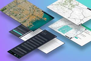
HERE Data Layers are standalone geospatial representations of the world’s road networks, pathways, buildings, structures, places, land use and land cover. They serve as a menu for developers and data scientists to select the datasets needed to power today’s location-based functions, applications and customer experiences.
“HERE has been a leading global B2B mapmaker for decades. Today, we’re ‘disaggregating’ our map via the HERE platform to empower users across all industries to tap the value of high-quality geospatial data,” said Mithun Dhar, Vice President, Developer Relations at HERE Technologies. “We are proud to support developers and customers in achieving better outcomes, whether that's by driving more engaging experiences, improving fleet, supply chain and road safety efficiencies, or by helping them operate more sustainably.”
The offering consists of customizable high value urban geospatial data sets in GeoJSON format and can be used in a range of use cases from map display, spatial analytics, business intelligence to AI/ML analysis.
HERE Data Layers include:
- Administrative Divisions: (Country, State, Province, Municipality, City or Built-up Area .
- Building: Man-made building structures with height and corresponding attribution.
- Destination Signs: Various destinations visible on a sign and relates such destinations to a specific path in the road network.
- Hydrography: Variety of water features (lakes, rivers, oceans, bays etc.).
- Land Cover: Content related to land physical coverage (woodland, wetlands, grassland, desert, glacier).
- Land Use: Content related to the functional usage of the land; it classifies areas of land for use by people.
- Navigable Road: Road Network with topology and Navigable Attributes.
- Places: Places and points of interest with corresponding location and related attribution.
- Traffic Restrictions: Represents specific paths in the road network where legal, logical or physical restrictions apply.
-
Traffic Signs: Signs along the road used to inform the driver of specific road situations (e.g. Warning Signs, Priority Signs, Stop Signs).
HERE Data Layers is available for all to access via the company’s Freemium developer plan at https://developer.here.com/products/data-layers.
About HERE Technologies
HERE, a location data and technology platform, moves people, businesses and cities forward by harnessing the power of location. By leveraging our open platform, we empower our customers to achieve better outcomes - from helping a city manage its infrastructure or a business optimize its assets to guiding drivers to their destination safely. To learn more about HERE, please visit
https://here.com and
https://360.here.com.
Media Contact
James Overstall
+49 171 533 4418
james.overstall@here.com
Jordan Stark
+1 312 316 4537
Jordan.stark@here.com
Attachment
![]()
HERE Data Layers


 Animation, 3D Art and 3D Models")