


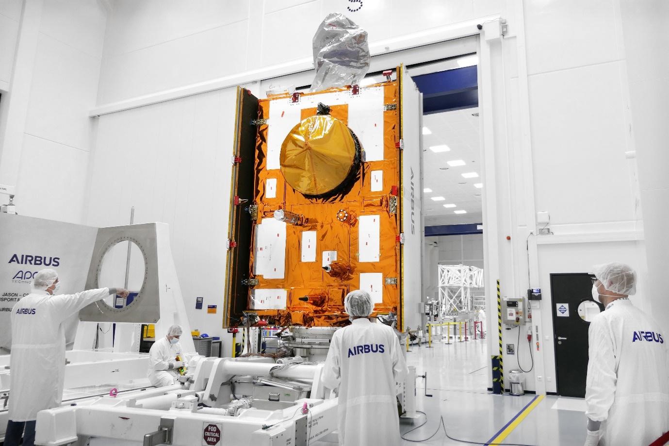
Sentinel-6B loaded in Container in Friedrichshafen / Sentinel-6B en transfert à Friedrichshafen /
Sentinel-6B wird in Friedrichshafen in den Transportcontainer verladen
Sentinel-6B introducido en un contenedor en Friedrichshafen
- Copyright Airbus / T. Locher -
Copernicus satellite "meets" space conditions during test campaign
@AirbusSpace @CopernicusEU @ESA_EO @NASAJPL @CMEMS_EU #sealevel #SpaceMatters #Sentinel6
Friedrichshafen, 03 December 2021 - Airbus has completed Sentinel-6B, the second ocean monitoring satellite of the European Copernicus programme, and is now testing it extensively over the next six months in preparation for its use in space.
"Copernicus Sentinel-6" mission is already delivering high-precision measurement of the topography of ocean surfaces through the first of two satellites, “Sentinel-6A”, launched in November 2020. The mission’s two satellites are built to measure the distance to the sea surface to an accuracy of a few centimetres and map it in a 10-day rhythm over a mission duration of up to seven years. Their purpose is to record changes in the height of the sea surfaces, variations in sea levels and analyse and observe ocean currents. Accurate observation of sea surface height changes provides information about global sea levels, the speed and direction of ocean currents and the heat stored in the oceans. The measurements – obtained from 1336 km above the Earth – are crucial for ocean modelling and predicting sea level rise.
This information helps governments and institutions to establish effective protection for coastal regions. The data is also valuable for disaster management organisations, and for authorities carrying out urban planning, flood protection schemes, or dyke construction.
As a result of global warming, global sea levels are currently rising by an average of 3.3 millimetres per year - with potentially dramatic consequences for countries with densely populated coasts.
Part of Europe’s Copernicus, Sentinel-6 is also an international collaboration between ESA, NASA, NOAA and Eumetsat.

Contacts for the media
Ralph Heinrich
Airbus Defence and Space
+49 171 304 9751
Airbus Defence and Space
+49 171 304 9751
Jeremy Close
Airbus Defence and Space
+44 776 653 6572
Airbus Defence and Space
+44 776 653 6572
Guilhem Boltz
Airbus Defence and Space
+33 6 34 78 14 08
Airbus Defence and Space
+33 6 34 78 14 08
Mathias Pikelj
Airbus Defence and Space
+49 162 29 49 666
Airbus Defence and Space
+49 162 29 49 666
Jesus Francisco Lechon
Airbus Defence and Space
+34 630 196 993
Airbus Defence and Space
+34 630 196 993


 Animation, 3D Art and 3D Models")