U.S. division primed for continued growth through expanded sales, marketing, operations and partner network
SOUTH JORDAN, Utah — (BUSINESS WIRE) — November 1, 2016 — Nearmap Ltd. (ASX: NEA) U.S. has completed a record first fiscal quarter, growing revenue 50 percent over the previous quarter. Customer annualized contract value (ACV)* for the high-resolution aerial image provider grew 53 percent over the same period of time. The U.S. business now has more than 400 customers.
This Smart News Release features multimedia. View the full release here: http://www.businesswire.com/news/home/20161101005963/en/

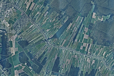
Nearmap provides government agencies and commercial businesses with high-resolution, frequently updated aerial imagery. Organizations using Nearmap save time and money, instead of having to send vehicles and staff on site. (Photo: Business Wire)
Nearmap’s subscription model is delivering growth in the United States with the addition of new customers and renewals from existing customers. The division is seeing minimal churn. Marketing momentum is building—qualified leads are running ahead of targets with improvement in measurement, conversion of leads to sales and an expanded multi-channel approach.
Nearmap provides government agencies and commercial businesses with high-resolution, frequently updated aerial imagery. Resolution is better than 2.8” GSD—sharper than satellite images. With frequent updates and the ability to deliver imagery within days of capture, Nearmap provides instant access through a refreshingly easy-to-use interface called MapBrowser™. Organizations using Nearmap save time and money, instead of having to send vehicles and staff on site. Nearmap customers have a productive, strategic advantage over their competition.
“Fundamentally, our imagery transforms the way people work,” said Patrick Quigley, senior vice president and general manager, North America, at Nearmap. “We are seeing great adoption of Nearmap across government, architecture, construction, engineering and the energy sector. As users visualize incredibly clear imagery, they rapidly make informed decisions. Our historical archive shows change over time—all of which can be instantly accessed from your desktop or mobile device. With Nearmap, our customers can efficiently plan, estimate costs and build proposals faster than ever. When it comes to design, construction or, for example, the installation of solar panels, high-resolution imagery allows them to get the job done with precision and accuracy.”
While Nearmap U.S. sells directly to organizations of any size, it also pursues a partner strategy. Nearmap imagery is easily accessible as a data layer inside Esri’s ArcGISSM platform, where users are building sophisticated GIS applications. A second partnership with OmniEarth blends the power of artificial intelligence and feature detection with Nearmap imagery, allowing users to derive advanced analytics used in water resource management, insurance claims analysis, property assessment and more.
In Q1, the OmniEarth partnership realized the first sales using Nearmap imagery, generating royalty income to Nearmap as well as Nearmap subscription sales to OmniEarth customers. Annual licenses generated from the Esri® relationship continue to roll in. Nearmap has also added TomTom to its customer base in the United States, providing real-time location information.
Nearmap’s business model is heavily supported by its continuous capture program. Customers don’t pay for areas to be flown specifically for them. Nearmap is constantly flying, capturing and streaming imagery into the cloud. Some of the latest areas captured include Bridgeport, Conn.; Atlanta; Savannah, Ga.; Lake Charles, La.; Boston; Grand Rapids, Mich.; Charlotte, N.C.; Buffalo, N.Y.; Cleveland; Providence, R.I.; and Waco, Texas. Areas effected by Hurricane Matthew were also captured and are being used to better manage the claims and underwriting processes for insurance.
About Nearmap
Nearmap empowers both government agencies and commercial businesses with spectacular, high-resolution, frequently updated aerial imagery. Nearmap’s breakthrough technology creates PhotoMaps™ of unparalleled quality. Frequent updates to imagery delivered within days of capture show changes over time by comparing current and historical imagery. This helps businesses make decisions quickly and with confidence. Nearmap users save time and money with reduced site visits, efficient planning and improved access. Free trials of Nearmap are available. For more information about Nearmap, visit http://go.nearmap.com.
*ACV = Annualized Contract Value – annualized value of all active subscription contracts in effect at a particular date.
View source version on businesswire.com: http://www.businesswire.com/news/home/20161101005963/en/
Contact:
SnappConner PR
Mark Fredrickson, 801-806-0161
Email Contact


